
CHC Navigation: The boat boost
April 10, 2023
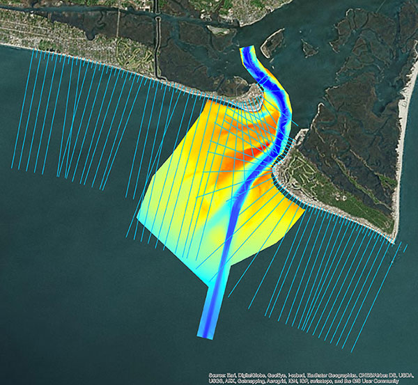
Numerous firms, large and small, have discovered how modest investments in USVs can completely revolutionize their hydrographic operations.
Read More
Numerous firms, large and small, have discovered how modest investments in USVs can completely revolutionize their hydrographic operations.
Following its March 29 acquisition of Geodynamics LLC, NV5 Geospatial has built a comprehensive suite of solutions for […]

Highly cost-effective autonomous marine drone for bathymetric surveys The new Apache3 Marine Drone — 2020 Edition provides a […]


Follow Us