ComNav releases unmanned aerial mapping package
April 22, 2022
ComNav Technology has released a powerful and reliable UAV aerial mapping solution capable of centimeter-level positioning, providing high-precision […]
Read More

ComNav Technology has released a powerful and reliable UAV aerial mapping solution capable of centimeter-level positioning, providing high-precision […]

Trimble announced today that it has entered into a definitive agreement to sell its Time and Frequency, LOADRITE, […]

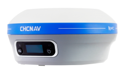
CHC Navigation (CHCNAV) has announced the availability of the i83 GNSS receiver, an addition to its premium GNSS […]

This newsletter will address estimates of vertical movement that will have to be accounted for in the new, modernized National Spatial Reference System.
Follow Us