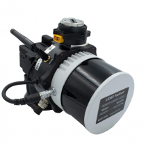
Inertial Labs releases laser for remote-sensing apps
February 1, 2023
Inertial Labs has released a remote sensing payload instrument. The Resepi Hesai XT32 laser is designed for accurate remote-sensing applications.
Read More

Inertial Labs has released a remote sensing payload instrument. The Resepi Hesai XT32 laser is designed for accurate remote-sensing applications.

Velodyne presents business cases of lidar solutions in forestry, utilities and surveying at AUVSI’s Xponential. Frank Bertini, UAV […]

https://www.youtube.com/watch?v=A_OSespRteU Velodyne‘s Frank Bertini talks about the company’s new 3D lidar VLP-16 Puck at the Association for Unmanned […]
Follow Us