
Hexagon helps Ghana utility modernize electricity distribution
April 8, 2022
Hexagon’s Safety, Infrastructure & Geospatial division successfully deployed an advanced utility geographic enterprise asset management (EAM) system for […]
Read More
Hexagon’s Safety, Infrastructure & Geospatial division successfully deployed an advanced utility geographic enterprise asset management (EAM) system for […]

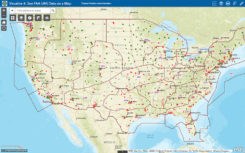
The Center for Systems Science and Engineering at Johns Hopkins University is tracking the coronavirus, COVID-19, via an […]

Birth of an epidemic Men wearing white bio-suits entered the market from the main entrance. A panic ensued […]
A new night map integration feature is available for all Concept3D maps. The toggle-on map overlay is designed to […]

Jeremy Kirkendall, senior GIS administrator for the NASA Disasters Program, gives GPS World an overview of the program […]
Changes to the Federal Aviation Administration (FAA) operational drone restriction were recently proposed in order to allow some […]

Drone Rescue will present its parachute systems DRS-5 and DRS-10 to the professional public for the first time […]
June’s Geointelligence Insider article on Jack Maple was the human interest article. One of the readers of June’s article […]


Follow Us