
Surveying on a busy runway
October 2, 2023
NV5 Geospatial is a large geospatial data company mainly supporting airport planning and engineering firms that must meet FAA survey and mapping requirements for data collection at airports.
Read More
NV5 Geospatial is a large geospatial data company mainly supporting airport planning and engineering firms that must meet FAA survey and mapping requirements for data collection at airports.
In January 2022, Mike Bevis and others prepared a white paper titled “The Geodesy Crisis,” documenting the concern about the lack of trained geodesists.
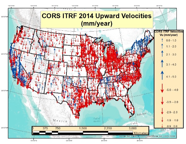
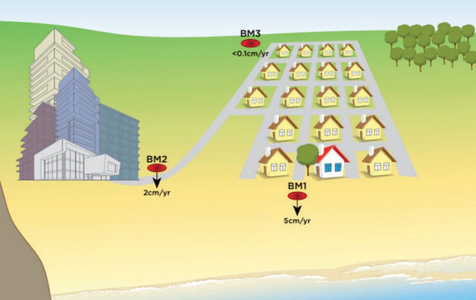
This newsletter will address estimates of vertical movement that will have to be accounted for in the new, modernized National Spatial Reference System.
The National Geodetic Survey (NGS) has revised an important technical document on the modernized National Spatial Reference System […]

The National Geodetic Survey (NGS) recently announced two new items related to the modernized National Spatial Reference System […]

Time. Ask anyone what time means to them, and they will give you a different answer. Benjamin Franklin […]

Impact of January 2016 GPS UTC Anomaly By Charles Curry / Presented at ION ITM, January 2017 On […]
As the Gulf Coast begins another hurricane season, researchers with the Conrad Blucher Institute for Surveying and Science […]


Follow Us