
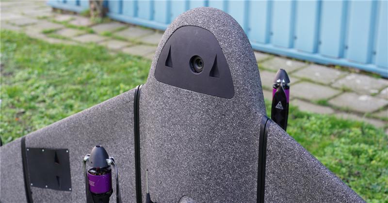
CHC Navigation: The boat boost
April 10, 2023
Numerous firms, large and small, have discovered how modest investments in USVs can completely revolutionize their hydrographic operations.
Read More
Numerous firms, large and small, have discovered how modest investments in USVs can completely revolutionize their hydrographic operations.
Atmos — a Dutch UAV manufacturer that develops VTOL fixed-wing UAVs for mapping and surveying applications — signed an agreement with Topcon.
In this month’s Insights column, Dave Zilkoski dives into the various methods of support that can be provided for the science of geodesy and surveying.

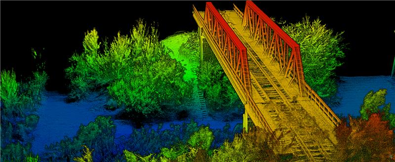
Leica Geosystems, part of Hexagon, has launched the Leica HawkEye-5, a new high-performance airborne bathymetric lidar solution for deep water surveying.
OxTS has released its Georeferencer 2.5 with the anyNAV feature and eight lidar sensors. Georeferencer 2.5 featuring anyNAV software is suitable for survey applications.

Inertial Labs has released its third generation of MEMS sensor-based inertial measurement units (IMU), MEMS KERNEL-210 and KERNEL-220.

Inertial Labs has launched its inertial measurement unit-P (IMU-P). It is an advanced MEMS sensors-based, compact, self-contained strapdown, industrial- and tactical-grade inertial measurement system and digital tilt sensor that measures linear accelerations, angular rates and pitch-and-roll with three-axis, high-grade MEMS accelerometers and three-axis, tactical-grade MEMS gyroscopes.
Even construction projects that involve separate pieces of heavy equipment can be tightly coupled, with GNSS as the “glue.” One example is Topcon’s SmoothRide paving system.


Follow Us